Area guide
Chesterfield
- Typical price
- Sales a year
- Change since 2016
- Top sale
Median, 2024 and 2025
Average, 2024 and 2025
Median 2016 to 2025
2024 and 2025
Chesterfield is a market town that's never quite been given the credit it deserves. It has a famous twisted spire, a market that's been trading for centuries, a fast train to London and Sheffield, and the Peak District twenty minutes up the road.
The town
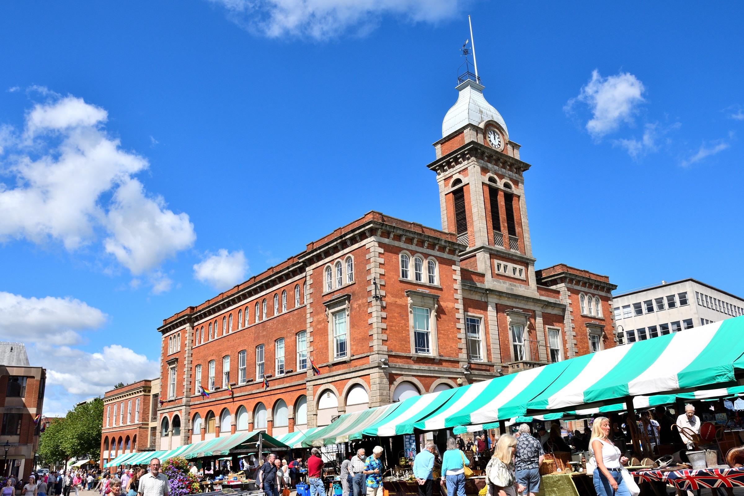
Everyone knows the Crooked Spire. The spire on the Church of St Mary and All Saints twists and leans, and you can see it from all over town. Below it, the market square has been trading for over eight hundred years and still fills up on market days.
Around the centre you've got Queen's Park, the shopping streets, and a good run of independent places on Chatsworth Road heading west. It's a town people grow up in, move away from, and very often come back to.
The homes
Chesterfield has a bit of everything, which is why it suits so many people. Victorian terraces close to the centre, inter-war semis, big 1960s and 70s estates, newer developments on the edges of town, and larger detached homes in Walton and Somersall.
Around 1,500 homes sell in the borough every year. Semis are the most common sale, and the typical semi goes for well under £200,000. That makes Chesterfield one of the better-value places to buy within reach of the Peak District.
Which side of town
The west side, around Brampton, Walton and Ashgate, faces the Peak and generally costs more. The north and east, including Newbold, Whittington and out towards Staveley and Brimington, is where you'll often get more house for the money.
We've written a separate guide to the west side, because that's where a lot of families want to be.
Worth knowing
Chesterfield station puts Sheffield a short train ride away and London St Pancras about two hours. The M1 runs down the east side of town, and the A619 takes you west to Baslow and Chatsworth.
School catchments make a real difference to prices on some streets. Check them with Derbyshire County Council before you fall for a house.
Getting about
- Sheffield city centre
- about 25 minutes by car
- M1 junction 29
- about 10 minutes by car
- Chatsworth House
- about 25 minutes by car
- Matlock
- about 20 minutes by car
- Manchester city centre
- about 85 minutes by car
- Sheffield by train
- about 15 minutes
- London St Pancras by train
- about 2 hours
Drive times are from the middle of Chesterfield with no traffic, worked out from OpenStreetMap (© OpenStreetMap contributors). Allow longer at rush hour.
Around Chesterfield
Neighbourhood by neighbourhood.
Living here
Schools, the river, and the year in Chesterfield.
Primary schools within 3 km
- Hady Primary School
Academy, ages 3 to 11 · 1 km
- Abercrombie Primary School
State, ages 3 to 11 · 1.1 km
- St Mary's Catholic Primary
State, ages 4 to 11, Roman Catholic · 1.1 km
- Spire Junior School
State, ages 7 to 11 · 1.2 km
- William Rhodes Primary and Nursery School
Academy, ages 2 to 11 · 1.4 km
- Hasland Infant School
State, ages 3 to 7 · 1.5 km
Secondary schools within 8 km
- Parkside Community School
Academy, ages 11 to 16 · 1.3 km
- Outwood Academy Hasland Hall
Academy, ages 11 to 16 · 2.1 km
- Outwood Academy Newbold
Academy, ages 11 to 18 · 2.2 km
- St Mary's Catholic High School, A Catholic Voluntary Academy
Academy, ages 11 to 18, Roman Catholic · 3 km
Flood warnings
The Environment Agency issues flood warnings for these areas within 2 km:
- Holme Brook at Ashgate
- River Hipper at Brampton
- River Hipper at Central Chesterfield
- River Rother at Birdholme
- River Rother at Central Chesterfield
- River Rother at Hady Hill
- River Rother at North Chesterfield and Old Whittington
- River Rother at Tapton
Not a rating for any one home. Check a postcode's long-term flood risk.
Through the year
- Chesterfield market
- Mondays, Fridays and Saturdays, with the flea market on Thursdays
- Chatsworth Country Fair
- early September, 25 minutes west
Dates move a little each year. Check before you go.
Before you buy, check
Schools from the Department for Education's register, measured in a straight line from the middle of Chesterfield; distance isn't catchment, so check admissions with Derbyshire County Council. Flood warning areas from the Environment Agency. Contains public sector information licensed under the Open Government Licence v3.0. Updated October 2026.
The numbers
What homes in Chesterfield actually sell for.
Real completed sales from HM Land Registry, not asking prices. Updated to August 2026.
By type, 2024 and 2025
| Detached | 918 sold | £325,000 |
| Semi-detached | 1389 sold | £185,000 |
| Terraced | 585 sold | £144,200 |
| Flat | 169 sold | £122,500 |
Price bands, 2024 and 2025
- Under £200k1546
- £200k to £300k882
- £300k to £500k547
- £500k to £750k76
- £750k and over10
Across town, 2024 and 2025
S40
Town centre and west: Brampton, Walton, Ashgate, Boythorpe
512 sales a year · typical price £214,500
S41
North and east: Newbold, Whittington Moor, Old Whittington, Hasland
520 sales a year · typical price £197,500
S42
South-west edge of the borough
32 sales a year · typical price £320,000
S43
Staveley, Brimington and Inkersall
454 sales a year · typical price £183,000
S44
Eastern edge of the borough
12 sales a year · typical price £165,000
Busiest streets, 2021 to 2025
Streets with at least four sales, so no single home's price can be picked out.
Every sale Land Registry records in the borough of Chesterfield. Standard market sales only. Contains HM Land Registry data © Crown copyright and database right 2026, licensed under the Open Government Licence v3.0.
Not sure it's the one?
Compare it with the rest of the area.
Tell us what you're looking for and we'll say whether Chesterfield fits, or where else might suit you better.
An AI tool that answers only from our own area data. Prices are guides from past sales (HM Land Registry), not valuations. We don't discuss individual homes for sale.
More area guides