Chesterfield neighbourhood guide
Staveley
- Typical price
- Sales a year
- Change since 2016
- Top sale
Median, Oct 2025 to Sep 2026
In 2025, the last full year
Median 2016 to 2025
Oct 2025 to Sep 2026
Staveley is a town in its own right, older than most of Chesterfield's suburbs. It grew with the ironworks and the pits, and today it's where a lot of the area's new homes are being built, which makes it one of the liveliest markets in the borough.
The place
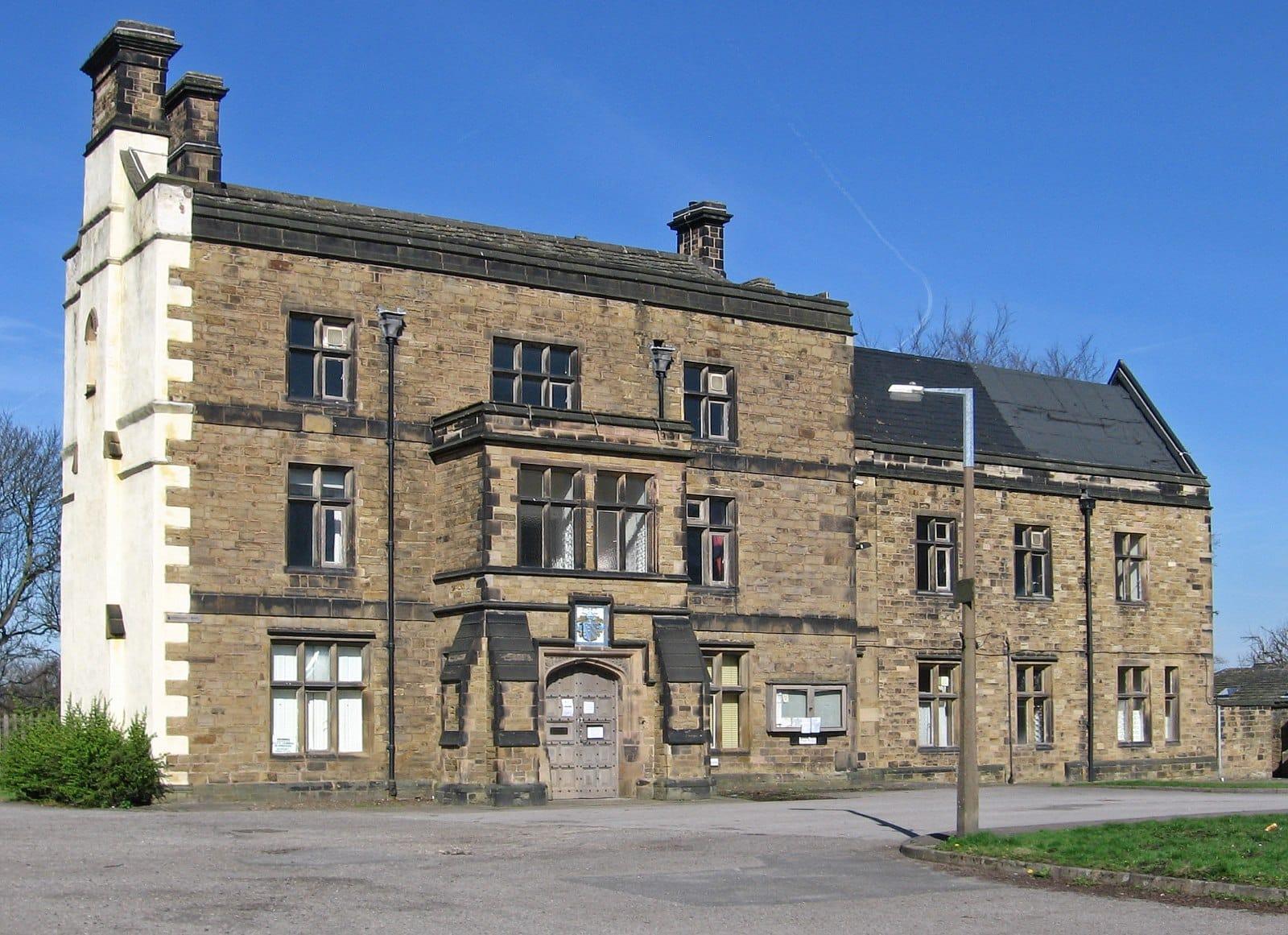
Staveley Hall, the 17th-century manor house by the church, is now home to the town council. The Chesterfield Canal comes through the town, and the restored basin has brought the towpath back to life.
The town centre has its own shops and pubs, and the estates spread out around it on every side.
The homes
Two very different markets side by side. Older terraces and semis around the town have sold for some of the lowest prices in the borough, on streets like Midland Terrace and Middlecroft Road.
Then there are the new estates. Cranleigh Road, Aspire Way, Swan Street and Curlew Street are among the busiest streets in the whole area, and Monarch Close, Lily Lane and Imperial Lane are where the biggest new homes have sold, for £400,000 and more.
Worth knowing
Netherthorpe School is the town's secondary. The M1 at junction 30 is about ten minutes away. The Rother and the Doe Lea both have Environment Agency flood warning areas near the town, so check flood risk on the lower streets. Buying new? Read our guide to new homes first.
Getting about
- Chesterfield station
- about 10 minutes by car
- Sheffield city centre
- about 25 minutes by car
- M1 junction 30
- about 10 minutes by car
- Chatsworth House
- about 30 minutes by car
- M1
- junction 30, about 10 minutes
- Sheffield by train
- from Chesterfield station, about 15 minutes
Drive times are from the middle of Staveley with no traffic, worked out from OpenStreetMap (© OpenStreetMap contributors). Allow longer at rush hour.
Living here
Schools, the river, and the year in Staveley.
Primary schools within 3 km
- Speedwell Infant School
State, ages 3 to 7 · 0.3 km
- Staveley Junior School
State, ages 7 to 11 · 0.4 km
- St Joseph's Catholic and CofE (VA) Primary School
State, ages 3 to 11, Roman Catholic/Church of England · 0.8 km
- Poolsbrook Primary Academy
Academy, ages 3 to 11 · 1.5 km
- Inkersall Spencer Academy
Academy, ages 3 to 11 · 1.6 km
- Barrow Hill Primary Academy
Academy, ages 3 to 11 · 1.6 km
Secondary schools within 8 km
- Netherthorpe School
Academy, ages 11 to 18 · 0.8 km
- Springwell Community College
Academy, ages 11 to 16 · 1.3 km
- Whittington Green School
State, ages 11 to 16 · 4.3 km
- Eckington School
Academy, ages 11 to 18 · 4.9 km
Flood warnings
The Environment Agency issues flood warnings for these areas within 2 km:
- River Doe Lea at Staveley
- River Rother at New Whittington
- River Rother at Staveley Business Centre
Not a rating for any one home. Check a postcode's long-term flood risk.
Through the year
- Chesterfield market
- Mondays, Fridays and Saturdays, with the flea market on Thursdays
Dates move a little each year. Check before you go.
Before you buy, check
Schools from the Department for Education's register, measured in a straight line from the middle of Staveley; distance isn't catchment, so check admissions with Derbyshire County Council. Flood warning areas from the Environment Agency. Contains public sector information licensed under the Open Government Licence v3.0. Updated October 2026.
Quick answers
Staveley in a sentence or two.
- How much does a house cost in Staveley?
- The typical price in Staveley over the last 12 months (Oct 2025 to Sep 2026) was £180,000, and 243 homes sold there in 2025. Typical prices by type: detached homes £272,500, semis £175,000 and terraces £156,500. These are completed sales from HM Land Registry, not asking prices.
- Have house prices gone up in Staveley?
- The typical price rose 55% between 2016 and 2025, from £123,750 to £191,995.
- How much is a detached house in Staveley?
- The typical detached home in Staveley sold for £272,500 over Oct 2025 to Sep 2026, from 30 sales. In 2025, 41 homes sold for £300,000 or more, and 3 for £500,000 or more.
- Where are the most expensive homes in Staveley?
- By typical sale price, the top streets are Monarch Close (£458,995), Lily Lane (£414,995) and Imperial Lane (£412,495), based on streets with at least four sales between 2021 and 2025.
- Which street in Staveley has the most sales?
- Cranleigh Road, with 39 sales between 2021 and 2025 at a typical price of £305,000.
- How far is Staveley from Sheffield?
- By car with no traffic, it's about 25 minutes to Sheffield city centre and about 10 minutes to Chesterfield station. Allow longer at rush hour.
- What schools are near Staveley?
- The nearest primary schools are Speedwell Infant School, Staveley Junior School and St Joseph's Catholic and CofE (VA) Primary School. The nearest secondary schools are Netherthorpe School and Springwell Community College. Distance isn't catchment, so check admissions with Derbyshire County Council.
- Does Staveley flood?
- The Environment Agency has flood warning areas nearby, including River Doe Lea at Staveley and River Rother at New Whittington. That doesn't mean every home is at risk, so check the long-term flood risk for the postcode.
- Is Staveley in the Peak District National Park?
- No. Staveley is outside the National Park, so planning goes through Chesterfield Borough Council.
The numbers
What homes in Staveley actually sell for.
Real completed sales from HM Land Registry, not asking prices. Updated to September 2026.
Stamp duty and moving costs on a £180,000 home · Compare Staveley with other areas
By type, Oct 2025 to Sep 2026
| Detached | 30 sold | £272,500 |
| Semi-detached | 91 sold | £175,000 |
| Terraced | 28 sold | £156,500 |
Price bands, Oct 2025 to Sep 2026
- Under £200k90
- £200k to £300k46
- £300k to £500k13
- £500k to £750k0
- £750k and over0
Busiest streets, 2021 to 2025
Streets with at least four sales, so no single home's price can be picked out.
Where to look, 2021 to 2025
About 41 homes a year sell for £300,000 or more in Staveley, and 3 for £500,000 or more. 5% of recent sales were new builds. See the prime market across the area.
Where the bigger homes sell
- Monarch Closemedian £458,995
- Lily Lanemedian £414,995
- Imperial Lanemedian £412,495
- Doutelle Gardensmedian £364,995
- Elizabeth Risemedian £360,996
- Winston Risemedian £325,295
Where to start
Often flats or small terraces, so check what sold.
- Midland Terracemedian £90,000
- Traffic Terracemedian £102,450
- Belmont Drivemedian £104,000
- Poolsbrook Avenuemedian £109,000
- Middlecroft Roadmedian £110,000
- Lowgatesmedian £110,000
Sales in the Staveley North, Staveley Central and Staveley South council wards. Standard market sales only. Contains HM Land Registry data © Crown copyright and database right 2026, licensed under the Open Government Licence v3.0.
Not sure it's the one?
Compare it with the rest of the area.
Tell us what you're looking for and we'll say whether Staveley fits, or where else might suit you better.
An AI tool that answers only from our own area data. Prices are guides from past sales (HM Land Registry), not valuations. We don't discuss individual homes for sale.
More area guides